
Detect with an old map lined up under your track
Import a scanned map, an old parcel plat, or an aerial photo and align it on the live satellite map, right under your GPS track. Then detect with your own reference layer beneath your feet.
Overlays sit on top of a whole map system: three base maps, the USGS historical layer, coverage and past tracks, and offline packs for when there is no signal.
A Pro feature. Android only.
The layers
Every layer below lives on the same live map, and you switch them on as you need them.
Base maps
FreeStreet, Satellite, and Terrain. Pick the look that reads best on the ground you are working.
USGS Historical
ProSwap your base map for genuine historical topo tiles with one tap. US and Romania.
Your own overlays
ProImport a scanned map, plat, or aerial photo and pin it to the live satellite map.
Precision align
ProMatch a few features to their real spots and lock the image to the ground, to the meter.
Coverage heatmap
ProA density map of where you have swept in the current session.
Track overlay
ProLoad past sessions as colored paths, or import a GPX or KML file. Up to 7 at once.
Session compare
ProPut two or more past sessions side by side, or overlaid with a blend slider.
Offline packs
ProDownload tiles for the whole area from four sources, so the map works with no signal.
Importing your own map
Take any map that lives on paper or in a photo and lay it over the real world at true scale.
Import an image
Bring in a PNG, JPG, WebP, or HEIC: a scanned old map, a parcel sketch, or an aerial photo. (No PDF, so export a page to an image first.)
Line it up by hand
Drag to move, pinch to scale, twist to rotate. Set the opacity anywhere from 10 to 100 percent so the ground reads through.
Detect on top of it
Your overlay stays pinned as you walk, right under your live GPS track and your finds.
Stack as many as you like
Keep several overlays on at once, name and rename them, and toggle each one, plus a master switch to show or hide them all. A Pro tool, with no cap on how many you pin.
Prep on a computer
Already aligned a map in the MapTrack web studio? Import the finished .sweepmap package and it lands in place, no on-phone lining-up needed.
Lay your own map over the real one
Import a scanned old map, a parcel sketch, or an aerial photo and align it onto the live satellite map. Drag to move, pinch to scale, twist to rotate, then detect with your own reference layer right under your tracks.
- Import a scan, sketch, or aerial photo
- Drag, pinch, and rotate to align it
- Adjustable opacity over the live map
- A Pro tool. Pin as many maps as you like
Precision align
When a hand-align is not tight enough, place control points and let SweepTrack do the math.
Match features
Tap a corner, crossroads, or building on your image, then tap the same spot on the real map.
See the fit in meters
SweepTrack fits the image to those points and shows the accuracy as an RMS readout in meters. Two points is usually enough.
Honest about the math
The fit is a similarity transform: move, scale, and rotate. It does not warp or rubber-sheet the image, so straight roads stay straight.
Pin your map to the exact spot
Drop a point on a feature in your imported map, then tap that same feature on the real map. Do it once or twice and SweepTrack locks the whole image to the ground, showing the fit in meters so you know how tight it is.
- Match features to their real-world spots
- Accuracy shown in meters as you place points
- Two points is usually enough
- Or just drag, pinch, and rotate for a quick align
The historical layer
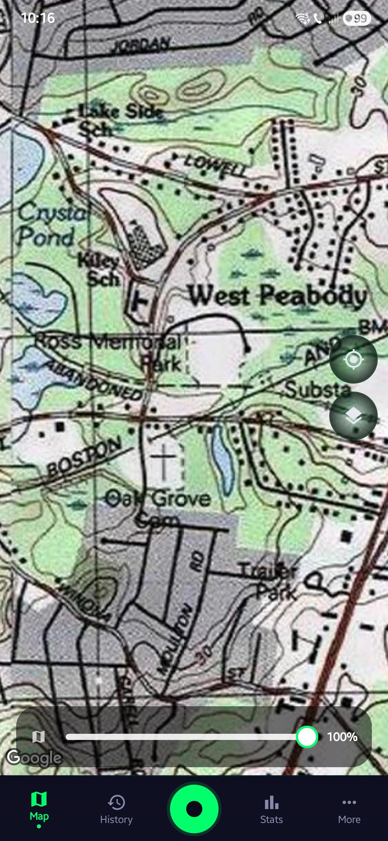
The historical layer is a base-map type. Tap it and your map becomes genuine old topo tiles, so vanished homesteads, schools, and roads show up where they once stood.
United States
USGS historical topographic tiles (USA_Topo_Maps) across the country.
Romania
Three eHarta series: Soviet 1:50k, Firing Plans 1:20k, and Austrian 1:200k. Outside these regions, your base map shows through.
What used to be there
Drag across to compare today's satellite view with a historical USGS topo of the same area. Old maps show schools, farmhouses, and rail lines that disappeared from modern maps long ago. Those spots are worth a closer look, and worth asking the landowner about.
The historical layer is part of Pro and covers the US and Romania. In the app it's one tap to switch to it, and you can download it for offline use.
USGS Historical Topo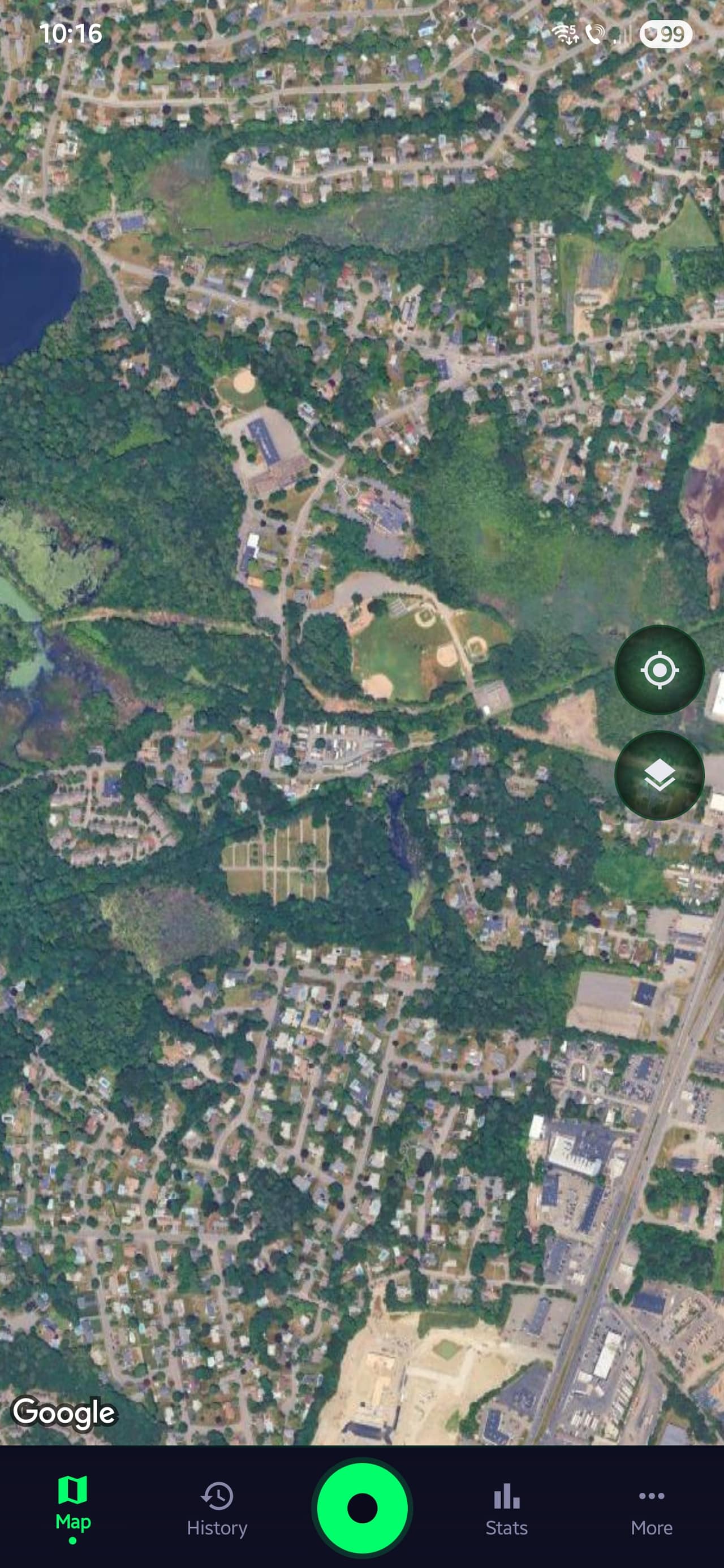 Modern Satellite View
Free and Pro
The base maps and field tools are free. The overlay system is where Pro earns its keep.
Free
- Three base maps: Street, Satellite, Terrain
- Compass, ruler, measure, and Go-To search
- Waypoints on the map
- Overlays you made while on Pro keep showing
Pro
- Import your own overlays, no limit on how many
- Precision control-point align with accuracy in meters
- The USGS historical (Old Map) layer
- Coverage heatmap and track overlay
- Session comparison, overlay and split view
- Offline packs from four tile sources
Pricing is set in Google Play and shown in the app, with a free trial when Google Play offers one.
Try it with a map of your own
Overlays are part of SweepTrack Pro. Install the app free and upgrade when you want the map tools.